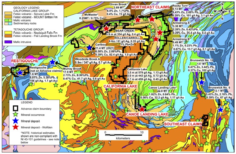
Bathurst Mining Camp
Highlights of Bathurst Mining Camp Project;
● Prolific VMS mining camp is considered to be one of the top 3 worldwide.
● Advance’s land package of 170 square kilometers is one of the largest in the district held
by a junior explorer.
● The Project is located within the key rock packages that host many of the mines and VMS
occurrences in the district.
● Includes 7 known historical VMS deposits with some that remain open for expansion.
● The largest known VMS deposit on the Project is the Canoe Landing Lake deposit that
has a historic estimate* of over 20 million tonnes grading 0.64% Pb, 1.82% Zn, 0.56% Cu,
32.23 g/t Ag, and 1.17 g/t Au (see note below).
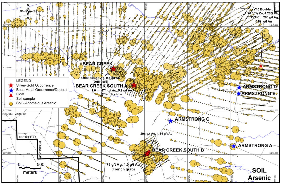
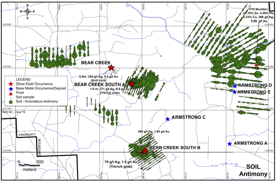
● Extensive soil sampling that shows distinct mineral trains, with up ice cut-offs, associated
nearby structures, pathfinder minerals as well as precious and base metals, that remain
open for exploration.
● Down ice from soil anomalies are several high-grade boulders that the bedrock sources
have yet to be found
Allan Barry Laboucan, President and CEO stated, “Our Bathurst Mining Camp Project gives us the opportunity to follow a well-established exploration model. By going into a historic mining camp that was tied up by Majors for many decades and now applying modern exploration techniques, we can see a huge possibility for discovery and resource development. The Bathurst district has been a prolific base metal and precious metal mining camp for many decades. Wolfden’s past work has not only documented the historic work but also recent exploration has identified new targets across the land package. Their work enables us to hit the ground running and prepare for upcoming drilling. It is rare that a junior explorer can hold a large land package in an important mining camp that is in a mining friendly jurisdiction such as New Brunswick. We are excited to have the opportunity to be part of this exceptional mining camp.”
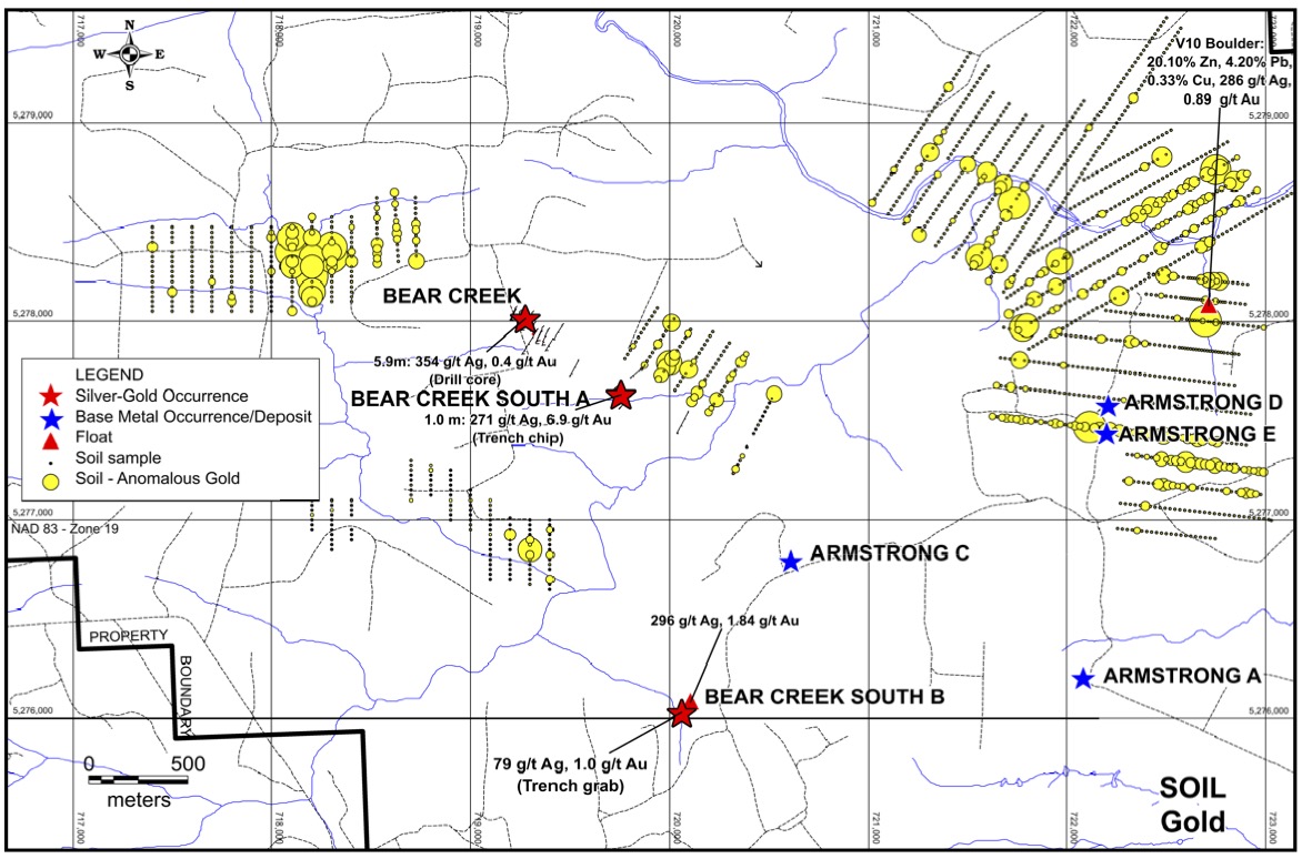
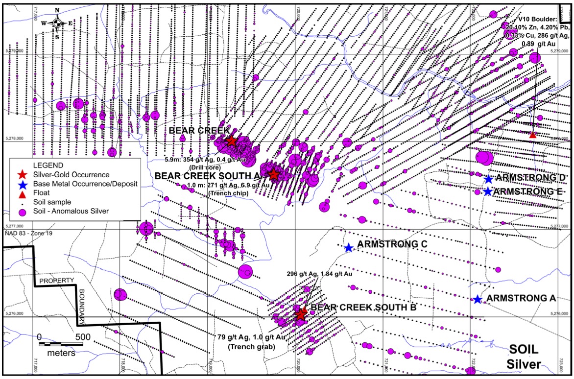
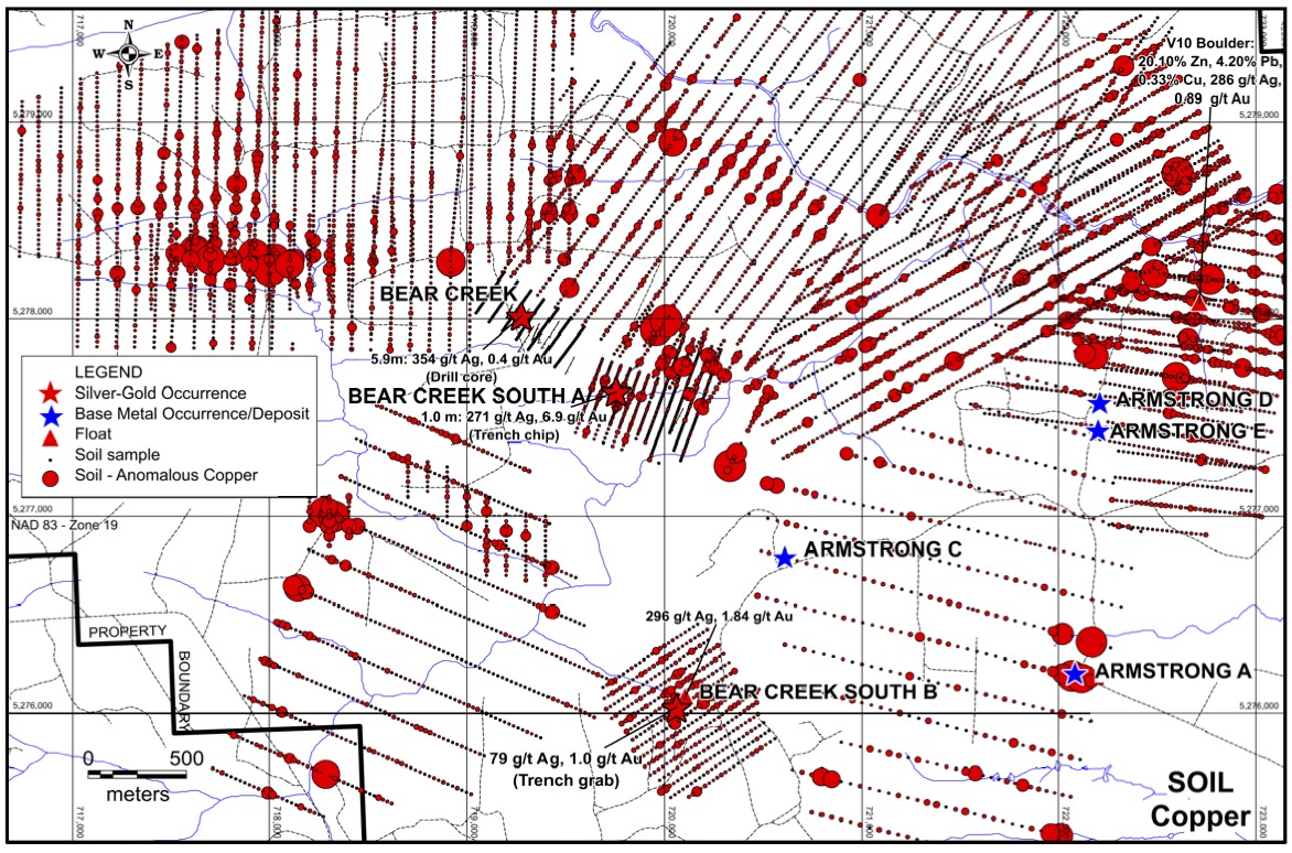
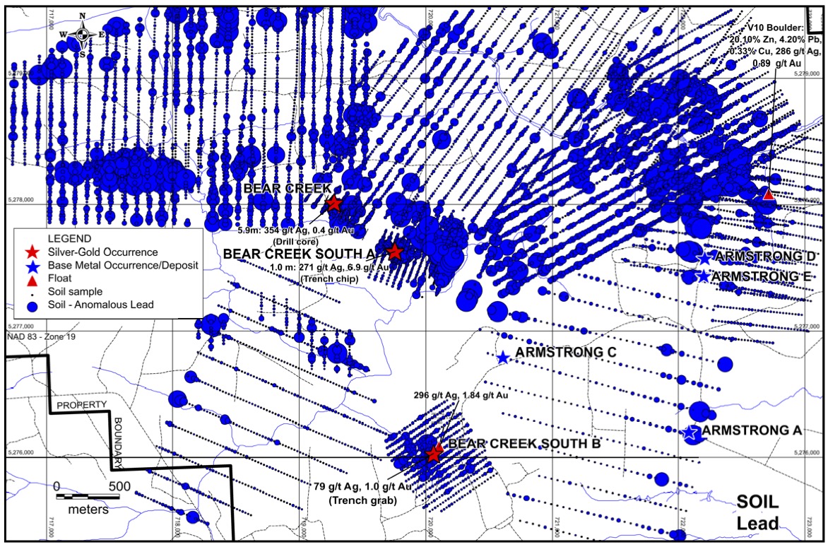
Northeast Claims. In the ground to the north and northeast there are a series of known historical VMS deposits, known VMS occurrences, high-grade boulders down ice from areas where extensive soil sampling has been done. The soil sampling grids show distinct mineral trains with coincident pathfinder minerals as well as base and precious metals with up ice cut-offs and key structures in close proximity.
The following map shows the extensive claims at the BMC project with the regional geology and known mineral deposits.
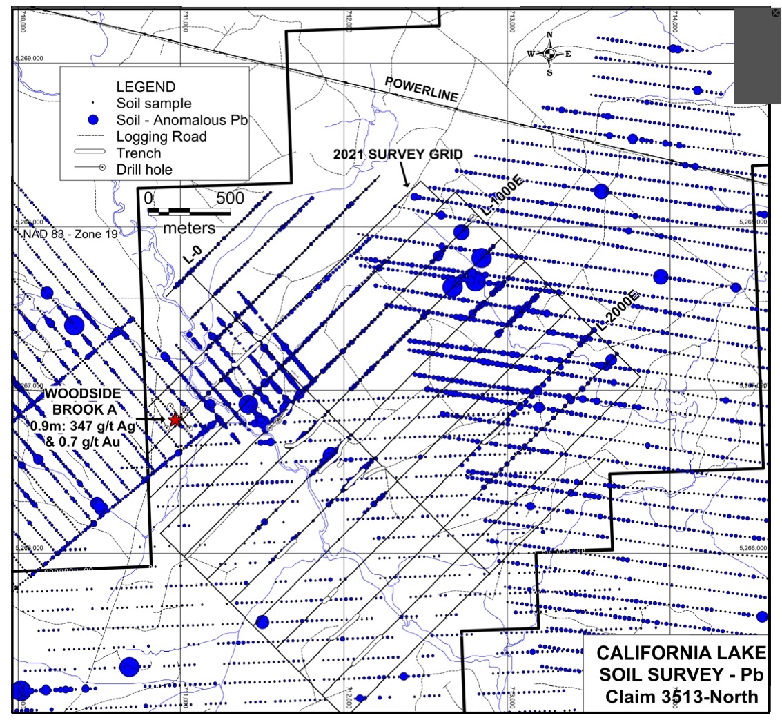
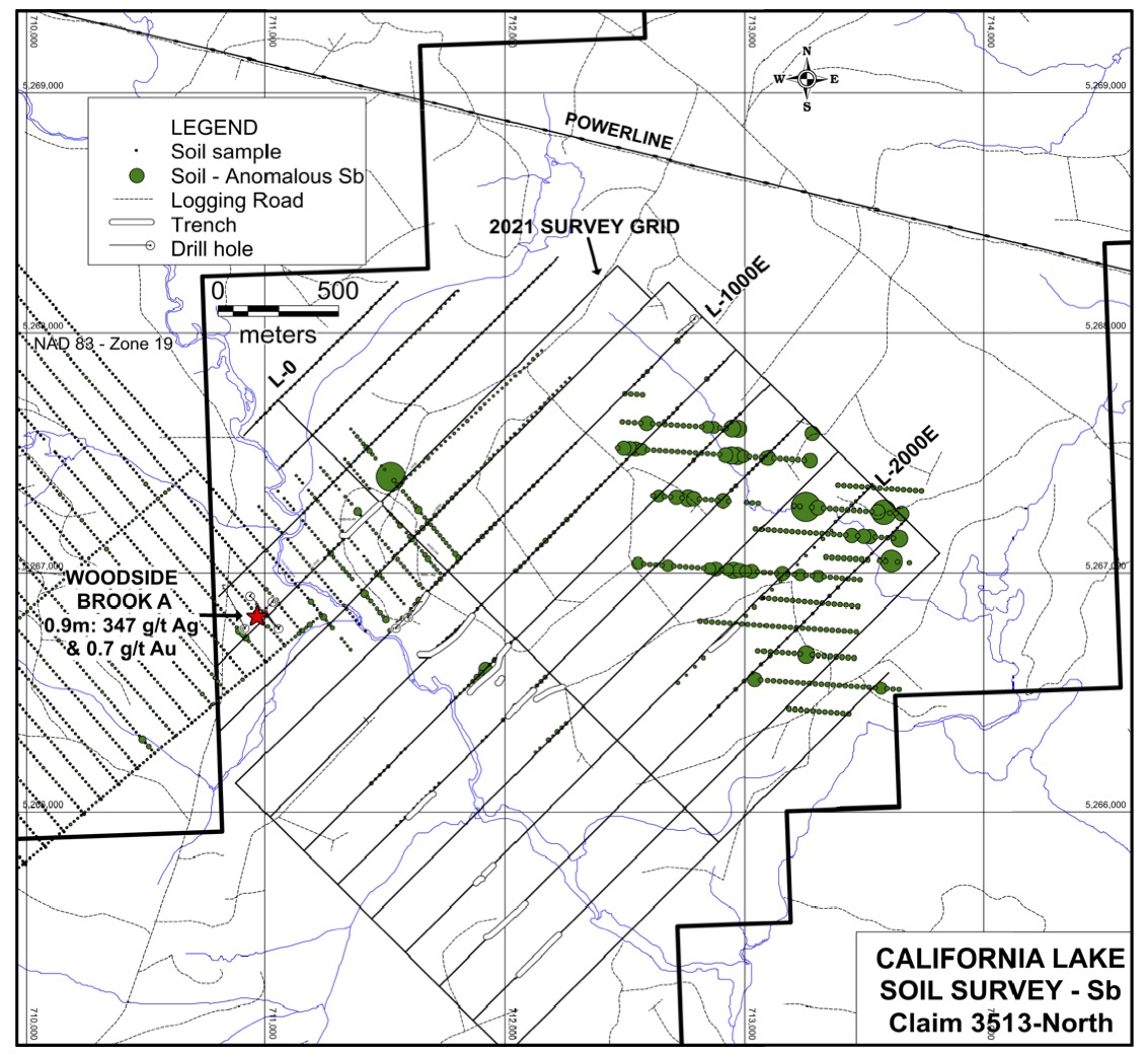
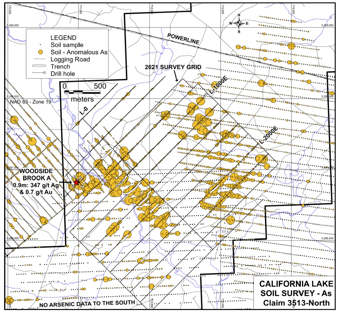
Surface Sampling Grids With Geochemical Results;

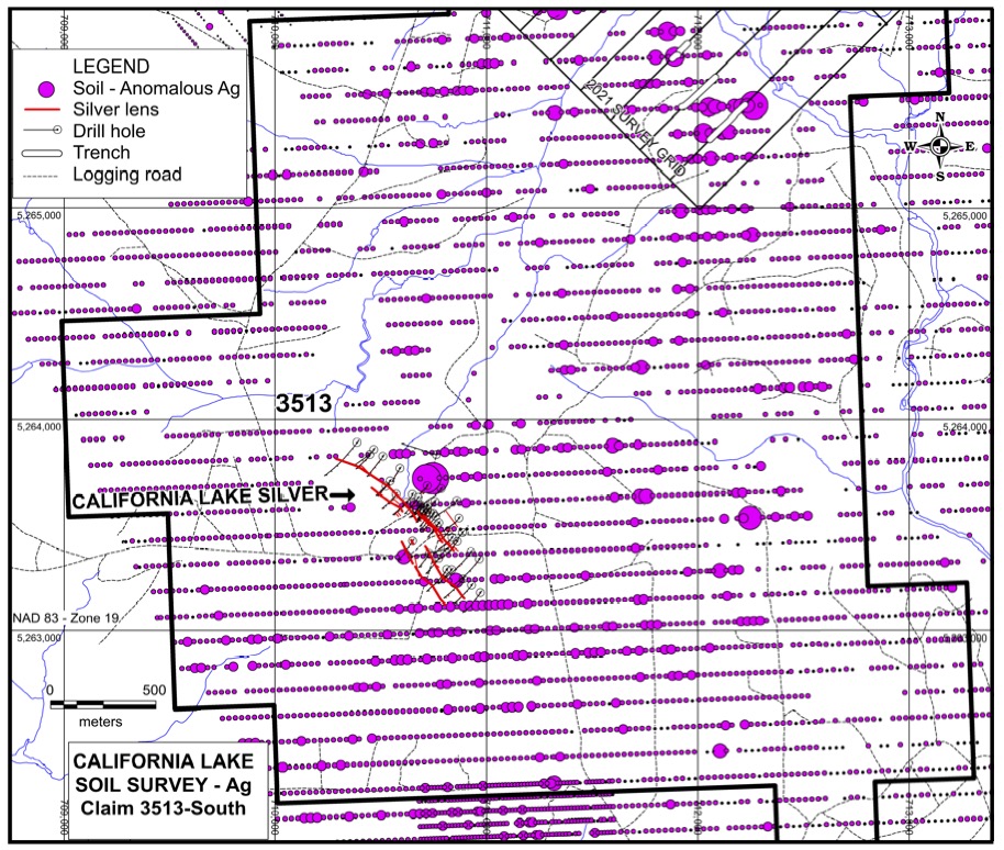
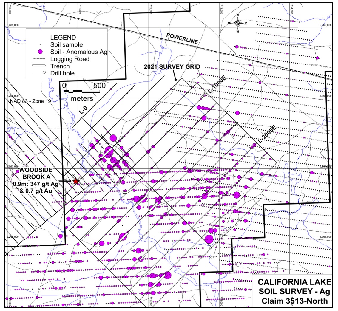
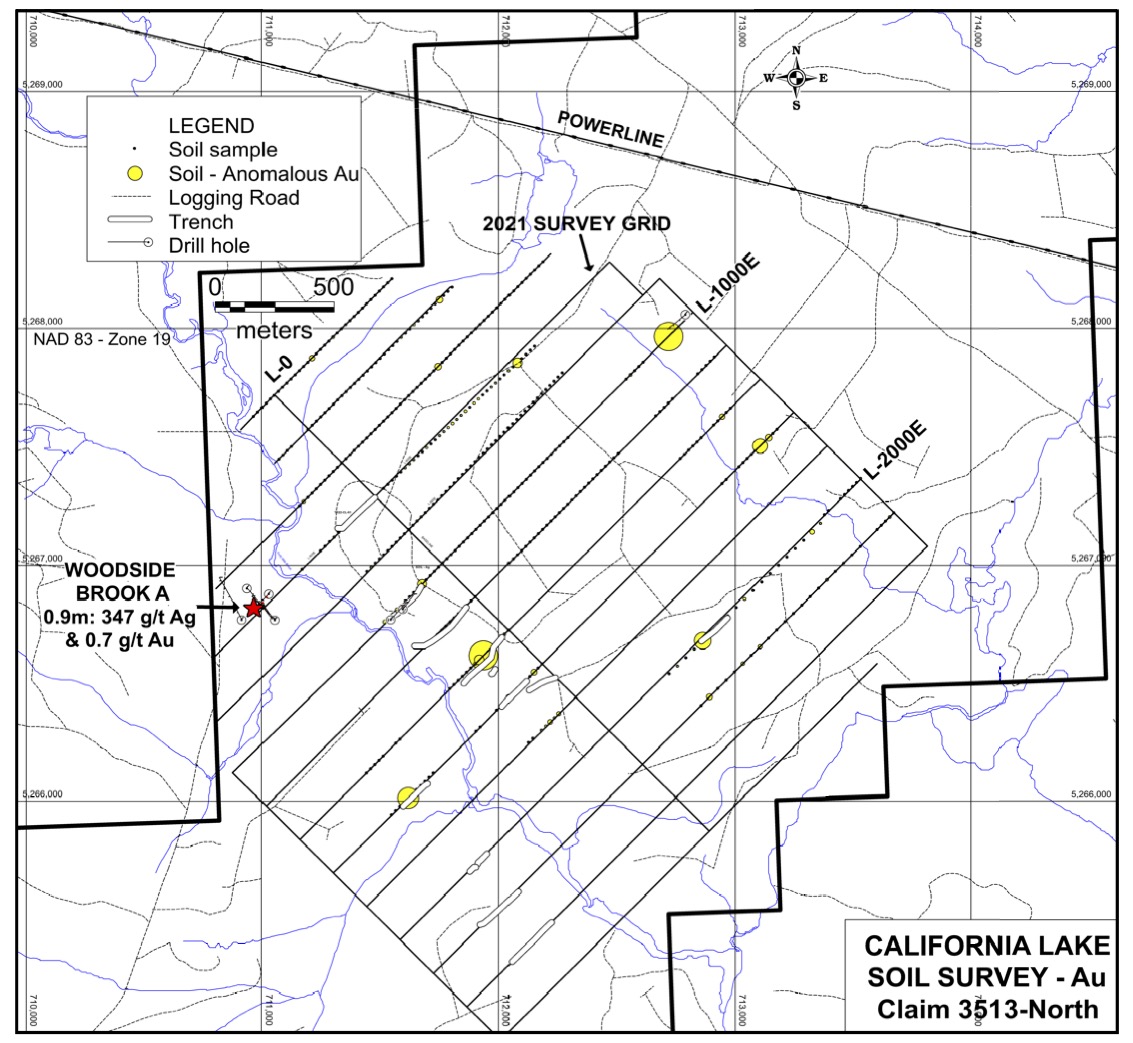
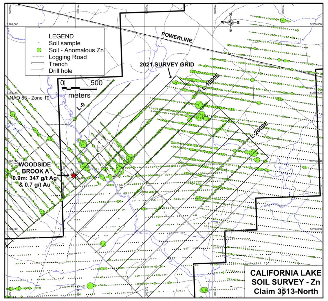
California Lake Claims are in the central area of the project. These claims contain a cluster of epithermal veins drilled by Wolfden and previous operators that included a grade of 6988 g/t silver over 0.20 m. Twenty holes had intersections exceeding 400g/t silver, with thicknesses ranging from under 1m to over 3m. These vein structures remain open for expansion and numerous soil anomalies on the California Lake claims remain untested or unexplained that may be indicative of similar mineralized zones.
Surface Sampling Grids With Geochemical Results;